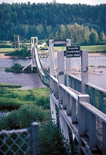
Southwest Miramichi River


The Southwest Miramichi River is a river in New Brunswick, Canada.[1][2]
The river has its origin in Carleton County, at Miramichi Lake in the Miramichi Highlands (a part of the Appalachian Mountains). Its two branches join near the hamlet of Juniper, Carleton County. Flowing initially southeast through heavy forests and large hills, the Southwest Miramichi River enters Northumberland County, is joined by the Taxis River at Boiestown then the larger volume flows northeast. The river is tidal below Renous-Quarryville. The Southwest Miramichi River joins the Northwest Miramichi River at Newcastle to form the Miramichi River.
The river is noted for Atlantic Salmon fishing. It is navigable by canoe throughout much of its length. Nearly every bend in the river, for example Push and Be Damned Rapids, has a distinctive name reflecting the importance of the river to fishermen, canoeists, and lumbermen.
It is sometimes referred to as the "Main Southwest Miramichi River" to distinguish it from the Little Southwest Miramichi River, a smaller, more northerly branch of the Miramichi River system. The Mi'kmaq referred to the river as Lustagoocheech, meaning "good little river" for canoeing.[3][4]
Tributaries
[edit]- North Branch Southwest Miramichi River
- South Branch Southwest Miramichi River
- Taxis River
- Cains River
- Bartholomew River
- Renous River
- Barnaby River
See also
[edit]References
[edit]- ^ Rayburn, A. (1975) Geographical Names of New Brunswick. Toponymy Study 2. Surveys and Mapping Branch, Energy Mines and Resources Canada, Ottawa
- ^ Geographical Names of Canada "Geographical Names of Canada". Archived from the original on 2009-02-07. Retrieved 2009-02-07.
- ^ Rayburn, A. (1975) Geographical Names of New Brunswick. Toponymy Study 2. Surveys and Mapping Branch, Energy Mines and Resources Canada, Ottawa
- ^ Geographical Names of Canada "Geographical Names of Canada". Archived from the original on 2009-02-07. Retrieved 2009-02-07.
46°49′47.6″N 65°47′1.9″W / 46.829889°N 65.783861°W
